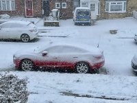
Getting colder but windy and wet here but then the real cold isn't going to arrive until around evening. Aside from parts of the SE Arpege not showing much snow until Monday or so but looks like the cold and wintery conditions will push well into the week.
You are using an out of date browser. It may not display this or other websites correctly.
You should upgrade or use an alternative browser.
You should upgrade or use an alternative browser.
Winter 2020/2021
- Thread starter Neil79
- Start date
More options
Thread starter's postsSoldato
Meteoradar snow radar shows a lot of snow all around us but not on us in Eastbourne. Typical
Soldato
Just started here (Few miles West of Norwich) although the stuff coming down is like icing sugar. At least the overnight wind has dried the ground and it’s settling straight away. Met office forecast currently shows heavy snow with at least 80% (Mostly 90%) chance of precipitation for every one of the next 24 hours so we could be in for some fun yet.
Soldato
I've slept in, but not even frost on the roofs, local Wunderground station currently reading +3C and feels like +3C with no breeze to speak of.
Last edited:
Commissario
Man of Honour
- Joined
- 21 Nov 2004
- Posts
- 45,038
Haha, no snow so far!
Soldato
Snowing here but not settling. Given the amount of rain since the start of the year I'm not surprised.
The southern end of the country will get some snow today - that grey mass is moving right to left.Meteoradar snow radar shows a lot of snow all around us but not on us in Eastbourne. Typical

Soldato
It's snowing now but it's not doing anything. Too wet around here. Needs to stop, dry out and then dump a load later.
The snow for the SE was delayed by around 6 hours. Heavier stuff should start to arrive this afternoon but it will still be pretty localised. The cold is here to stay for a while though so there should be plenty more chances for snow in the coming week
The snow for the SE was delayed by around 6 hours. Heavier stuff should start to arrive this afternoon but it will still be pretty localised. The cold is here to stay for a while though so there should be plenty more chances for snow in the coming week
I don't really trust the GFS but it has some quite remarkable, relative to anything we've had of late, signals for a longer, colder, patch over the next few days - with the jet pushed away from us for most of the week it probably holds up. Unfortunately though it mostly looks dry without a lot of opportunities to produce snow more widely

Interesting stuff with high pressure after that as well - the end of the current GEM run shows more cold on its way from the east.
Associate
Some of the ens member outputs are again cracking, still outside of the reliable timeframe but onto something again in 2 weeks time.
Control and operational runs are good for extended cold after this weekend so I'm happy to ignore these milder outlier members popping up.
Control and operational runs are good for extended cold after this weekend so I'm happy to ignore these milder outlier members popping up.
Man of Honour
- Joined
- 21 Nov 2004
- Posts
- 45,038
Some of the ens member outputs are again cracking, still outside of the reliable timeframe but onto something again in 2 weeks time.
Control and operational runs are good for extended cold after this weekend so I'm happy to ignore these milder outlier members popping up.
English please

Soldato
By this time tomorrow you'll have 3 or 4 more inches than that
Associate
English please
Weather models have a suite of runs called an Ensemble (Ens) that all run with slightly different conditions to produce a range of outputs. So for example the Global Ensemble Forecast System (GEFS) has a suite of runs each producing a different output based on the starting data. If the output from all 30 runs is clustered together then there is a high level of certainty, if there is a wide spread of outcomes from cold to mild then its more difficult to nail down.
The runs measure a variety of things from 2m surface temp, upper air temps, snow risk, sea level pressure etc and generate a mean chart.
Soldato
BBC predicting 'heavy snow' from 6pm onwards here.. yeah right 

Soldato
BBC predicting 'heavy snow' from 6pm onwards here.. yeah right
And tomorrow. Chin off BBC weather mate, clueless. Met Office showing no snow either day but a 10% chance and yet BBC showing heavy snow constant from 6pm this evening till midday tomorrow.
Last edited:


